
How it works
Address in. Quantities out.
Four steps from property search to a takeoff your estimators can price.
From search to completed takeoff
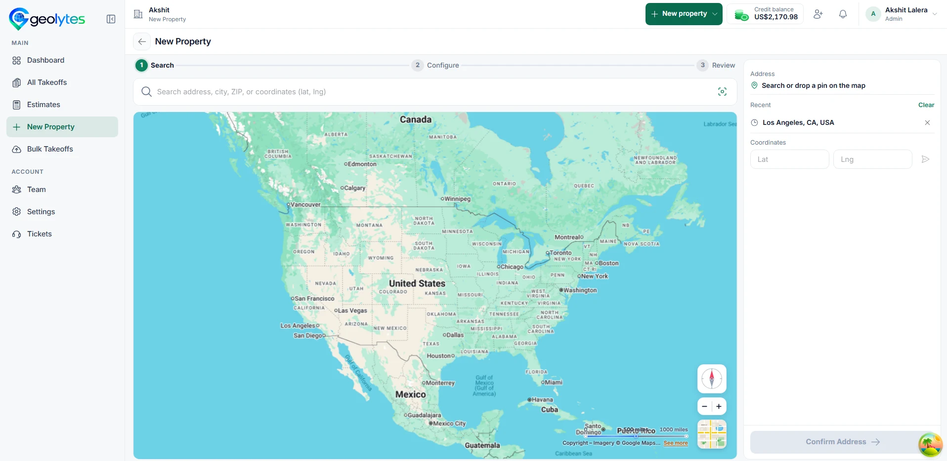
Search by address, city, ZIP, or coordinates and confirm the site on aerial imagery.
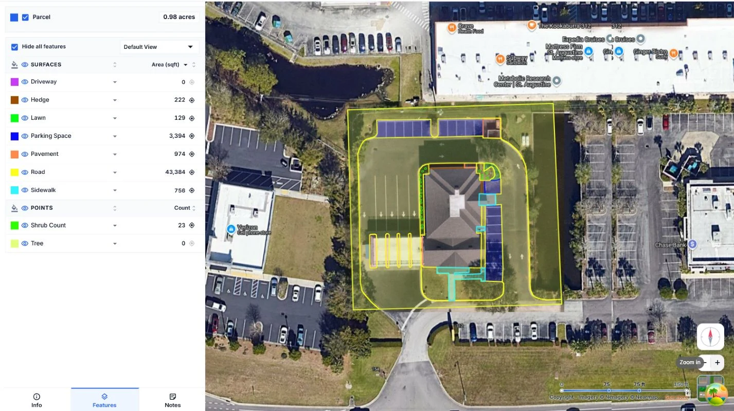
Pick the surfaces and counts your work depends on: turf, beds, parking, sidewalks, shrubs.
Review the parcel outline so the takeoff matches the property you’re bidding.
Each surface arrives as its own layer with a quantity you can inspect, share, and export.
Capabilities
One workflow, five stages.
Each stage hands clean data to the next, from the first measurement to a list of hundreds of addresses.
- 01 Measure
Aerial takeoffs
Enter an address and measure the surfaces in the job.
See measuring - 02 Organize
Measurement layers
Keep turf, beds, parking, and sidewalks in separate layers.
Inspect the sample - 03 Price
Estimating preview
Apply your rates to measured quantities. Local preview with sample data.
See the preview - 04 Hand off
Exports & sharing
Download CSV and share takeoff views with your team.
See team workflows - 05 Scale
Bulk projects
Upload addresses by CSV and group takeoffs into projects.
See bulk takeoffs
Bulk takeoffs
A list of addresses uses the same steps.
Portfolio and multi-site teams upload addresses once and keep every property’s details organized in a project.
- 01
Upload a CSV
Bring a list of addresses and group the takeoffs into one project.
- 02
Track status
See what is drafted, in progress, or ready to price.
- 03
Share the view
Estimators and operations work from the same layers and quantities.
Get started
Ready to try it on a real site?
Inspect the free sample, measure a property yourself, or book a walkthrough with an address you need to price.